
|
Arborfield
|
|
Properties
Related sites:
'The Poplars' - now known as Molebridge Farm
Modern aerial photo of Newland Farm and the crossroads, courtesy of Multimap
|
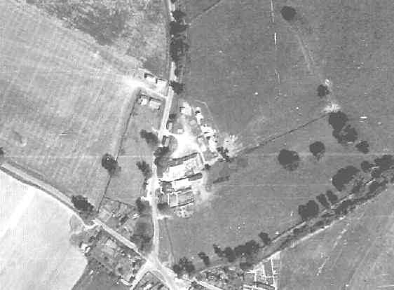
Detail from RAF aerial photo of part of the parishes of Newland and Arborfield, dated 10th July 1946, ref. 3142, reproduced by permission of the National Monuments Record, English Heritage.
This view shows Newland Farm, Pond Cottages, the pond, the five-way cross-roads and the 'Bull' public house. Note the outbuildings in the field to the left of the Sindlesham Road; this site is now occupied by Lockey Farm.
Back to Aerial Photos main page
|
|||
|
Any Feedback or comments on this website? Please e-mail the webmaster |