
|
Arborfield
|
|
Properties
Related sites:
'The Poplars' - now known as Molebridge Farm
Modern aerial photo of Bearwood Lake and Garden Cottages, courtesy of Multimap
|
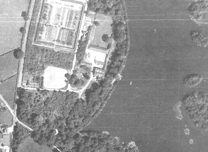
Detail from RAF aerial photo of part of the parish of Newland, dated 10th July 1946, ref. 3142, reproduced by permission of the National Monuments Record, English Heritage.
This view shows the walled garden, the garden cottages and old gas-works, the south-west corner of Bearwood Lake, and West Lodge. In the bottom left-hand corner is the junction of Gravelpit-Hill Lane and Mole Road, with the 'Mole' public house on Mole Road, and 'The Glen' (now known as 'Cordery Cottage') on the lane up to Carter's Hill to the left. Back to Aerial Photos main page
|
|||
|
Any Feedback or comments on this website? Please e-mail the webmaster |