
|
Arborfield
|
|
Properties
Related sites:
'The Poplars' - now known as Molebridge Farm
Modern aerial photo of Church Lane, courtesy of Multimap
|
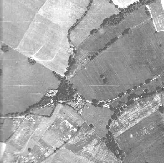
Detail from RAF aerial photo of part of the parish of Arborfield, dated 10th July 1946, ref. 3142, reproduced by permission of the National Monuments Record, English Heritage.
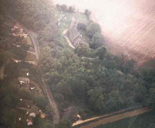
This view shows Church Lane with St. Bartholomew's Church and the much smaller graveyard, which has since been extended to the left, as shown in another aerial view, taken in 1985, seen below. The lane past Monk's Cottage meanders northwards towards Cocklebury Cottages on Arborfield Hall Farm. Mole Road forms an arc in the bottom right-hand corner, but there is a curious track running parallel with it; did this have a military purpose? There is a clear track on the edge of the field to the north of the church; the track and the clumps of trees on its boundary have long since disappeared. There is evidence of Army huts and recent activity in the fields south of the church.
There only appear to be three houses south of Church Lane. Contrast this
with the number of houses in 1985, seen here: Back to Aerial Photos main page
|
|||
|
Any Feedback or comments on this website? Please e-mail the webmaster |