Arborfield
Local History Society

 Aerial Photos of Arborfield and Newland

USAAF aerial photo of Carter's Hill and Winnersh

RAF aerial photo of Lower Arborfield

RAF aerial photo of Bearwood Stables, Newlands Mansion, Arborfield Cross, School Road and Langley Common Road

RAF aerial photo of Arborfield Cross, Arborfield Court, Ducks Nest Farm and part of Arborfield Garrison

OS aerial photo of Arborfield Cross,  Arborfield Court, Ducks Nest Farm and part of Arborfield Garrison


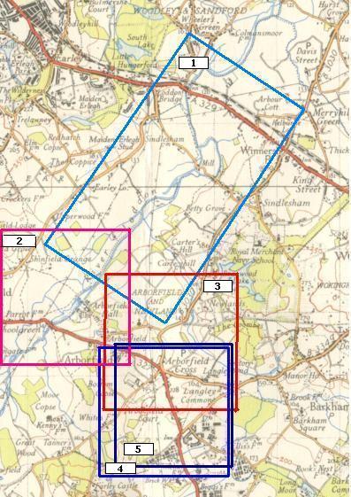
Thanks to a grant from Arborfield and Newland Parish Council, the History Society has been able to purchase a set of aerial photographs of the combined parish from the National Monuments Record, English Heritage.

We have permission to publish the photos on our web-site. The old Ordnance Survey map below shows the coverage of each photo.

The areas covered by the five photos are shown here


1:   USAAF aerial photo of Carter's Hill and Winnersh, dated 8th March 1944, ref. 5045.


2:   RAF aerial photo of Lower Arborfield, dated 10th March 1946, ref. 4042.


3:   RAF aerial photo of Bearwood Stables, Newlands Mansion, Arborfield Cross, School Road and Langley Common Road, dated 10th July 1946, ref. 3142.


4:   RAF aerial photo of Arborfield Cross, Arborfield Court, Ducks Nest Farm and part of Arborfield Garrison, dated 10th March 1946, ref. 3040.


5:   Ordnance Survey aerial photo of Arborfield Cross,  Arborfield Court, Ducks Nest Farm and part of Arborfield Garrison, dated 30th August 1961 and now out of copyright, ref. OS/61034 frame 72.


Back to Properties Page


Any Feedback or comments on this website?  Please e-mail the webmaster