
|
Arborfield
|
|
Properties
Related sites:
'The Poplars' - now known as Molebridge Farm
|
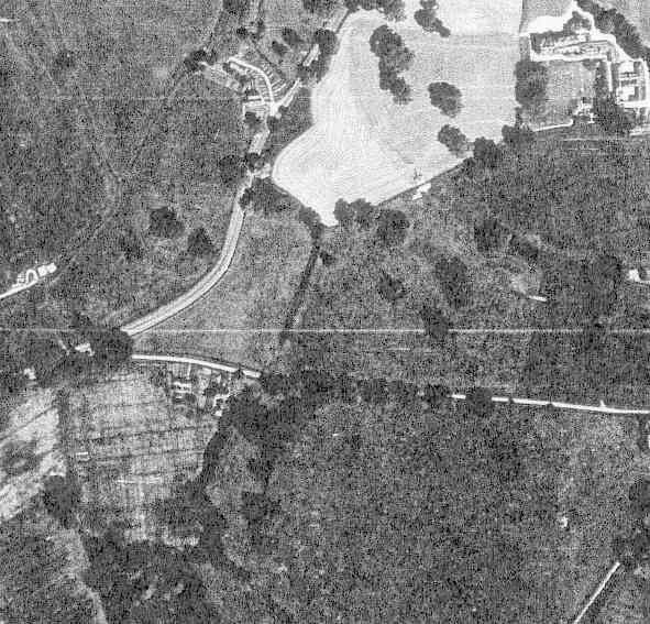
Detail from RAF aerial photo of part of the parish of Newland, dated 10th July 1946, ref. 3142, reproduced by permission of the National Monuments Record, English Heritage.
This view shows the lane named 'Ellis Hill', running from Mole Road up the hill to Ellis Hill Farm. Hughes Green is at the bottom of the lane by the Mole Brook. There are two semi-detached buildings at Hughes Green. To the left is a thatched cottage, later converted to a single dwelling and now known as 'Hunters Point', while the other pair is known as 'Brook Cottages'. After the 1947 Auction sale of Newlands, Brook Cottages were re-divided into what is known as a 'flying freehold'. The cottage further away from the Mole Brook had an extra bedroom above its neighbour. However, the two cottages have now reverted to the more usual division along the party wall. There is a footbridge over the Mole Brook, but in the 1990s a road bridge was constructed without permission, composed of concrete beams. The Council ensured that the road bridge was removed. Back to Aerial Photos main page
|
|||
|
Any Feedback or comments on this website? Please e-mail the webmaster |