
|
Arborfield
|
|
Properties
Related sites:
Reading Road and Swallowfield Road School Road, Link Way, Melrose Gardens, Eversley Road Duck's Nest and Targett's Farms, Eversley Road |
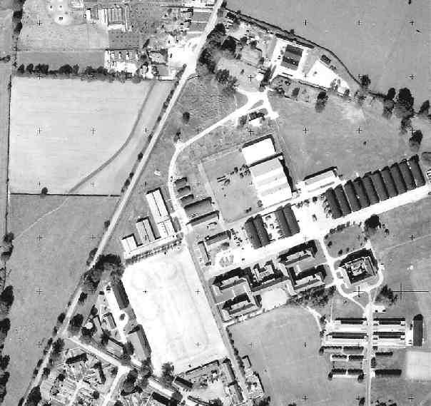
This is part of an Ordnance Survey aerial photo of Arborfield Cross, Arborfield Court, Ducks Nest Farm and part of Arborfield Garrison, dated 30th August 1961, ref. OS/61034 frame 72, supplied by the National Monuments Record, English Heritage, now out of copyright, and reproduced under licence from Ordnance Survey. Note the '+' marks, used when creating a map from the photo.
Here are Langley Common Road and Biggs Lane in Barkham, with the workshops and college buildings as they were in 1961. Much has changed since then. On the left of Langley Common Road is the Oaklands mobile-home site, which has since been enlarged. The cafe has been replaced by a tyre company.
Back to Aerial Photos main page
|
||
|
Any Feedback or comments on this website? Please e-mail the webmaster |