
|
Arborfield
|
|
Properties
Related sites:
Reading Road and Swallowfield Road School Road, Link Way, Melrose Gardens, Eversley Road Duck's Nest and Targett's Farms, Eversley Road |
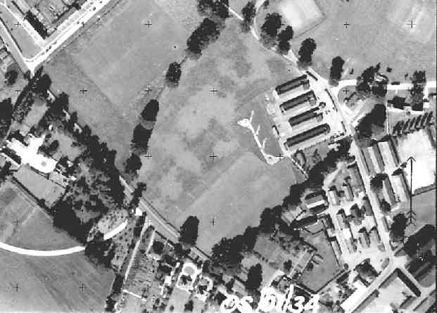
This is part of an Ordnance Survey aerial photo of Arborfield Cross, Arborfield Court, Ducks Nest Farm and part of Arborfield Garrison, dated 30th August 1961, ref. OS/61034 frame 72, supplied by the National Monuments Record, English Heritage, now out of copyright, and reproduced under licence from Ordnance Survey. Note the '+' marks, used when creating a map from the photo.
Here is the southern part of Eversley Road, after passing Poperinghe Barracks. Whitehall Farm can be seen to the left, with a semi-circular road that has long since disappeared. Baird Road now cuts from the bottom left-hand corner of the view up to the top right. The military buildings on the right have mostly been demolished, and the Community Centre occupies part of the site. The old Eversley Road at the bottom of this view is now a cul-de-sac called Sheerlands Road, and provides access to Gerring Close and the Badgers Mount estate.
Back to Aerial Photos main page
|
||
|
Any Feedback or comments on this website? Please e-mail the webmaster |