
|
Arborfield
|
|
Properties
Related sites:
Reading Road and Swallowfield Road School Road, Link Way, Melrose Gardens, Eversley Road Duck's Nest and Targett's Farms, Eversley Road Eversley Road near the Brickworks |
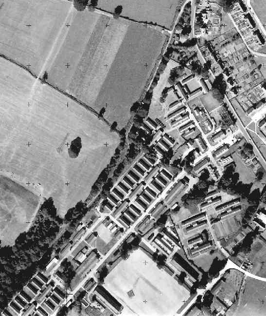
This is part of an Ordnance Survey aerial photo of Arborfield Cross, Arborfield Court, Ducks Nest Farm and part of Arborfield Garrison, dated 30th August 1961, ref. OS/61034 frame 72, supplied by the National Monuments Record, English Heritage, now out of copyright, and reproduced under licence from Ordnance Survey. Note the '+' marks, used when creating a map from the photo.
Here is Poperinghe Barracks with its entrance on what used to be Eversley Road, now Bramshill Close. Wokingham Lane marks the northern boundary of the Barracks. By 1969, the Garrison By-Pass cut through the complex; the three 'spiders' of huts at the left-hand side were all that remained of the buildings until they were replaced by the 'Poppyfields' development in 2004. The land to the east of the By-Pass was cleared of buildings apart from the Guardroom on Bramshill Close, and a new Community Centre took their place. All that has now gone, replaced by Penrose Park. Note the size of the gardens of the Council Houses on Eversley Road (which was still the main A327 until by-passed). These gardens were later shortened to allow for the development of Council bungalows and maisonettes in Valon Road.
Back to Aerial Photos main page
|
||
|
Any Feedback or comments on this website? Please e-mail the webmaster |