
|
Arborfield
|
|
Properties
Related sites:
Reading Road and Swallowfield Road Duck's Nest and Targett's Farms, Eversley Road Eversley Road near the Brickworks |
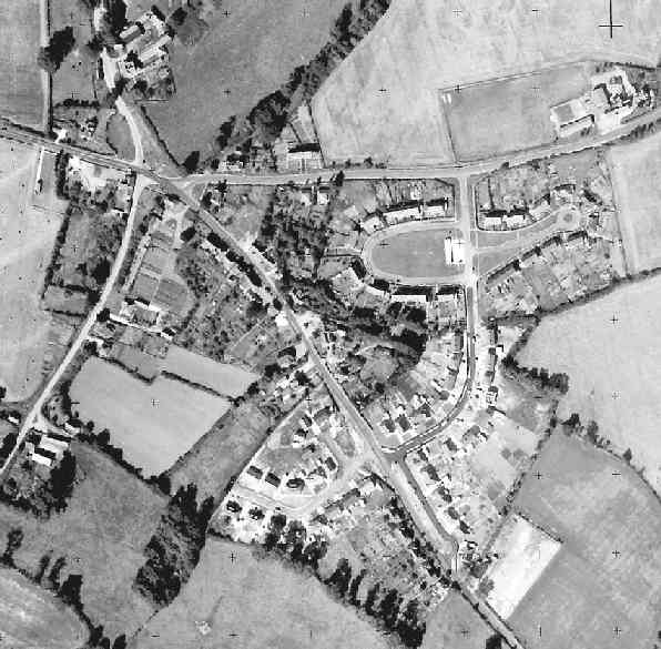
This is part of an Ordnance Survey aerial photo of Arborfield Cross, Arborfield Court, Ducks Nest Farm and part of Arborfield Garrison, dated 30th August 1961, ref. OS/61034 frame 72, supplied by the National Monuments Record, English Heritage, now out of copyright, and reproduced under licence from Ordnance Survey. Note the '+' marks, used when creating a map from the photo.
Here is the main settlement at Arborfield Cross, showing Eversley Road from the five-way junction to just beyond Harts Cottages (next to 'Hillcrest') and the site of the British Legion. Note the lengths of the back gardens of 'Hillcrest'; these were later shortened to make room for Harts Close. Along School Road, the school has gained a playing field. This field would later be extended right up to the semi-detached houses. Note the temporary classrooms facing the playground. Note the lengths of the gardens of the houses on Eversley Road nearer to the crossroads. On the other side, Post Office Cottages had been demolished, leaving rather a gap stretching to School Road.
Returning to the main photo above, Link Way and the bungalows along Eversley Road had recently been completed. Opposite them is the first phase of Melrose Gardens, the bungalows being very similar to those built at Shinfield Rise.
The land
behind Arborfield Stores was sold for development in 1962, and three
pairs of semi-detached houses were then built either side of Melrose
Gardens, plus a detached
Soon afterwards, the Chamberlain's estate was started, taking Melrose Gardens to a temporary exit on Swallowfield Road.
The Chamberlain's estate was
built in three segments:
Back to Aerial Photos main page
|
||
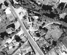 Whitewell Cottages can be seen, facing No. 2 Melrose Gardens.
Eventually, these were replaced by Whitewell Close. On the close-up to
the right, on one side is the Garage at the top, then Magnolia Cottage, then Whitewell Cottages. On the other side, from the top, is Sunrise, then
the Village Hall, then Arborfield Stores and its out-buildings.
Whitewell Cottages can be seen, facing No. 2 Melrose Gardens.
Eventually, these were replaced by Whitewell Close. On the close-up to
the right, on one side is the Garage at the top, then Magnolia Cottage, then Whitewell Cottages. On the other side, from the top, is Sunrise, then
the Village Hall, then Arborfield Stores and its out-buildings. 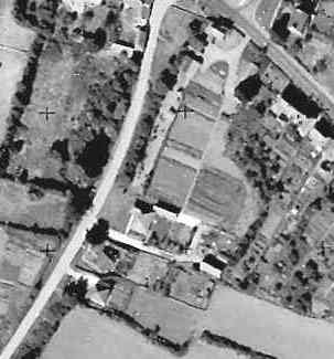 house.
 |
Any Feedback or comments on this website? Please e-mail the webmaster |