
|
Arborfield
|
|
Properties
Related sites:
Reading Road and Swallowfield Road School Road, Link Way, Melrose Gardens, Eversley Road Duck's Nest and Targett's Farms, Eversley Road Eversley Road near the Brickworks |
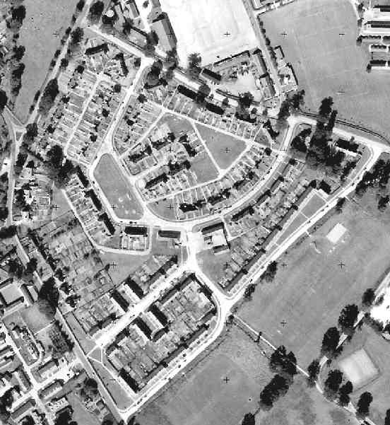
This is part of an Ordnance Survey aerial photo of Arborfield Cross, Arborfield Court, Ducks Nest Farm and part of Arborfield Garrison, dated 30th August 1961, ref. OS/61034 frame 72, supplied by the National Monuments Record, English Heritage, now out of copyright, and reproduced under licence from Ordnance Survey. Note the '+' marks, used when creating a map from the photo.
Here are the married quarters bounded by the southern part of Eversley Road and Biggs Lane. Much has changed, not least the fact that most of these houses are now privately owned. The road layout has since changed markedly; there is no longer any road access to the fronts of the houses facing the green in the lower right-hand corner.
Back to Aerial Photos main page
|
||
|
Any Feedback or comments on this website? Please e-mail the webmaster |