
|
Arborfield
|
|
Properties
Related sites:
|
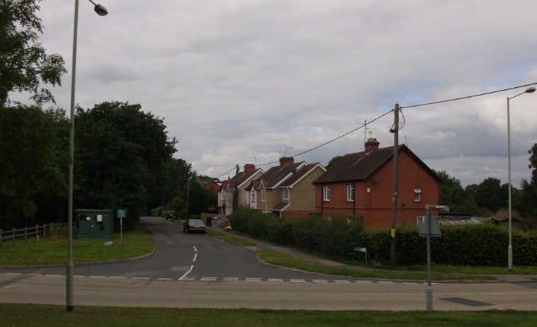
This article was prompted by the release in 2011 of more Garrison houses for private sale, and relates the history of these houses. When the Remount Depot
opened in 1904, the Army employed civilians to look
after most of the camp's functions. Key personnel lived outside the
borders of the camp. During WWI, the Army took more direct control of the
Depot in order to cope with the greatly-increased workload. When WWI
ended, the camp again employed civilians. Wokingham Rural
District Council built two
rows of semi-detached houses along what was then Eversley
When the Remount Depot closed in 1937 , it was soon reopened as 'Arborfield Garrison', home to the RAOC Depot in 1938 and the new Army Technical School in 1939.
At this stage,
married quarters had been built in and around what is now known as
Valon Road. During WWII,
these were augmented by more temporary accommodation, but since then the
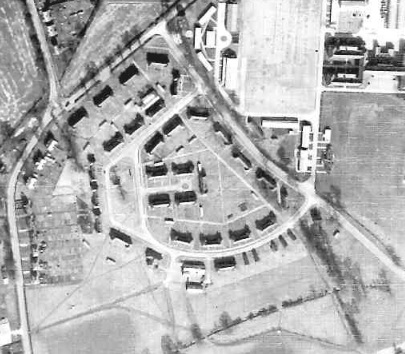
1939 brick-built houses have regularly been updated. Here's an aerial
photograph (courtesy of the National Monuments Record ) showing
them as they were in
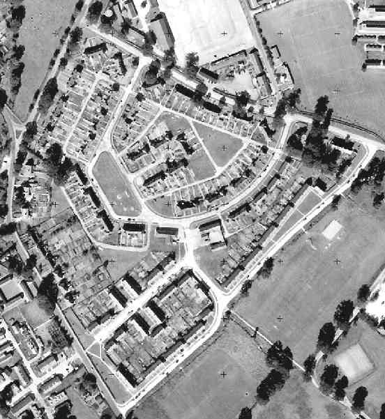
1946. In the top left-hand corner is Eversley Road (now Rickman Close) and its junction with Langley Common Road, whose junction with Biggs Lane is at the top centre. Eversley Road continues southwards on the extreme left of the photo, with the 'Bramshill Hunt' P.H. just visible opposite the Council Houses. More houses were built by around 1960 to round-off the block of married quarters bounded by Biggs Lane, Princess Marina Drive, Eversley Road and Langley Common Road. Officers' married quarters were further to the south of Moat House , on and behind Biggs Lane and clustered around a cricket pitch. A later aerial photograph taken for the Ordnance Survey on 30th August 1961 (and reproduced under licence from the National Monuments Record) shows Venning Road adjoining the Rugby field:
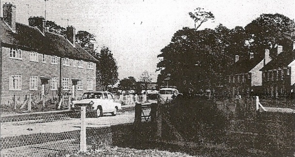
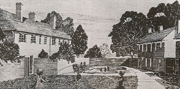
The Garrison Bypass was opened in 1969, with space to convert it to a dual carriageway. It severed much of what had been Poperinghe Barracks , leaving the 'spiders' of wooden buildings on the far side of the bypass to become a Piggery. In early 1971, the Ministry of Defence announced a scheme to upgrade their housing stock to take away the 'rough edges'. It involved 50,000 houses around the country, and Arborfield Garrison was to be the first to benefit. They published some before-and-after illustrations as shown below.
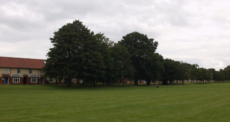
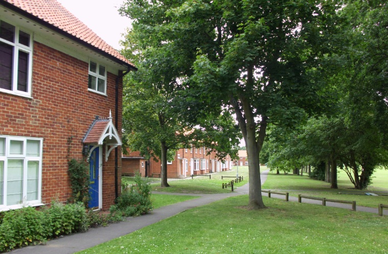
The MoD had access to far greater funding than did the local authorities, so the Army was able to carry out its scheme, and in addition to build a new estate of wedge-shaped houses in Faraday, Fleming and Kelvin Closes, appropriate names for the School of Electronic Engineering. The re-vamped estate was bounded by a new road named 'Baird Road', which for much of its life was to be fenced-off to prevent through traffic. Part of Baird Road has since been opened-up to provide access to Penrose Park. The old A327 Eversley Road was broken up into sections: Rickman Close to the north of Langley Common Road, then Bramshill Close and Whitehall Drive separated by a grass strip to prevent through traffic to Baird Road, and finally Sheerlands Road. The now-quiet lanes still have their old road markings and 'cats'-eyes' to show that they were formerly a main road. The biggest change was that the road linking Eversley Road to Biggs Lane, south of a long line of post-war houses, was replaced by wide tree-lined footpaths as shown below.
At the other end of this estate (now largely sold off as private houses) is Baird Road, which parallels Langley Common Road.
|
||||||||||||||||||||


|
Any Feedback or comments on this website? Please e-mail the webmaster |