
|
Arborfield
|
|
Properties
Related sites:
Reading Road and Walden Avenue Arborfield Cross and School Road Swallowfield Road, White's and Bartlett's Farms Duck's Nest Farm and Eversley Road ----- Article on Poperinghe Barracks, from the 'Arborfield Old Boys' web-site
|
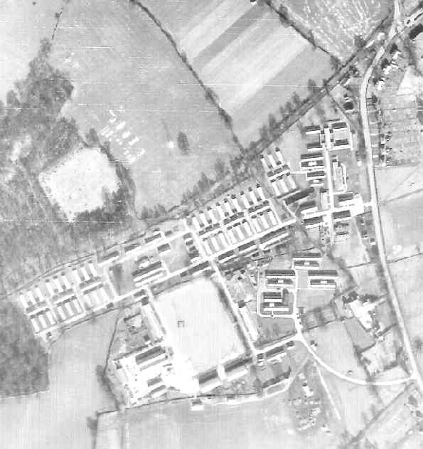
Detail from RAF aerial photo of part of the parish of Arborfield, dated 10th March 1946, ref. 3040, reproduced by permission of the National Monuments Record, English Heritage.
This is the site of Poperinghe Barracks, sandwiched between Eversley Road and Wokingham Lane, with the 'Bramshill Hunt' public house at the apex towards the top of the picture. All of the military buildings have now completely disappeared, while the pub has grown in size. The Barracks had been used until just before D-Day in 1944 by the Royal Artillery, and became the 'Training Battalion and Depot R.E.M.E.' in July 1946. Lining the west side of Eversley Road are some old cottages, now replaced by Whitehall Mews. Further south are other houses that now form part of Sheerlands Road. On the other side of Eversley Road are the Council Houses; note the very long back gardens, which were later cut back in order to develop the line of bungalows built in Valon Road in the 1970's.
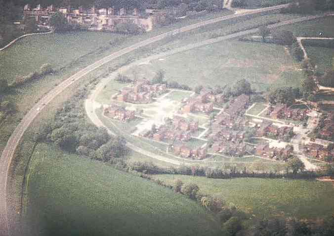
To the east of the Garrison By-Pass, a new service-road known as Baird Road was created, as shown in the aerial photo taken in 1985 (seen below, with the Piggeries in the distance). Baird Road was fully equipped with street lights, and was intended to serve the new Married Quarters in Kelvin Close, Faraday Close and Fleming Close, seen in the foreground of this photo. However, Baird Road was severed by two sets of locked gates by the late 1980's (though it was still a public bridleway), and these weren't removed until after the Penrose Park estate was completed.
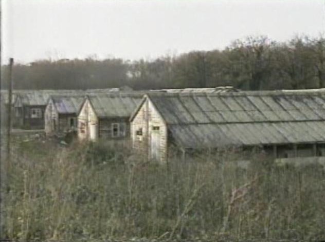
The land to the east of the By-Pass and Baird Road was cleared of most of its huts, leaving just the guardroom, post office and newsagency on what remained of Eversley Road (now a cul-de-sac named Bramshill Close). Behind these buildings was a modern Community Centre, home to the Thrift Shop and Nursery until the end of the 1990's when a replacement Community Centre was built off Sheerlands Road. This allowed the Ministry of Defence to sell off the entire area for development, and it has now developed into Penrose Park. Finally, the Piggeries, temporarily used as light industrial units in the late 1990's, became the 'Poppyfields' estate, served by a road named 'Poperinghe Way'. The only known remains of Poperinghe Barracks is a piece of wooden flooring cut to size and laid at St. Bartholomew's Church by the late Wally Barlow. Back to Aerial Photos main page
|
|||
|
Any Feedback or comments on this website? Please e-mail the webmaster |