
|
Arborfield
|
|
Churches
Related sites:
Old Church and
Arborfield Hall
|
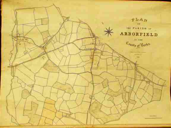
There are known to be four copies of the 1839 Tithe Apportionment Map; one for the Church (kept in the Junior School), one for the civil Parish (held by the Local History Society), one at the Berkshire Record Office, and one to the Tithe Commissioner in London. The Map shows all land holdings within the old Arborfield Parish, and excludes any land in the Liberty of Newland, so there is a curious gap where Arborfield Cross was, excluding the 'Bull', the Parish Cottages and other buildings further along the Swallowfield Road. To see more detail, move the mouse and click on different parts of the main map, or click on one of the links shown on the lower left-hand side. Almost all of the houses should be on one or more of the detailed maps.
Terrier for Tithe Apportionment Map 1839 |
||
|
Any Feedback or comments on this website? Please e-mail the webmaster |